

Mapas de Merced (Continued)
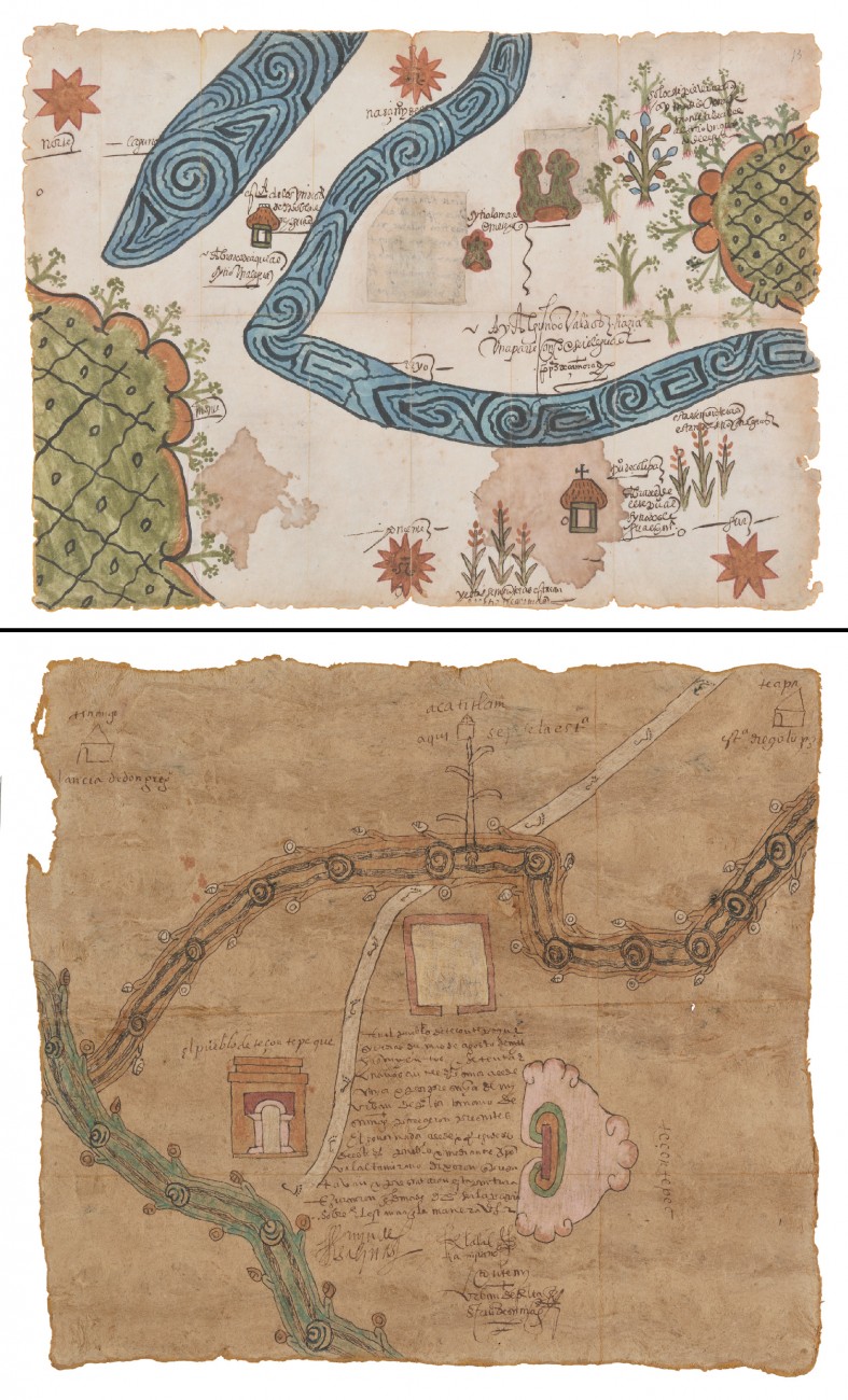
Map of Zolipa Misantla, Veracruz, 1573 (2021 copy)
Map of Tezontepec, Hidalgo, 1571 (2021 copy)
photo © Museum Associates / LACMA
Audio Guide
In these two facsimile maps, we see the continuity of Mesoamerica’s cartographic imagery into the sixteenth century. Swirling and coiling shapes evoke the fluid movement of rivers. The green hills of Colipa bear the traditional grid-and-dot pattern that symbolizes the bumpy skin of the crocodilian earth. There are European elements, too. Churches emerge as regional centers, reconfiguring landscapes around new axes. And alphabetic writing provides a distinctive visual means to encode living histories in new ways. The map of Tezontepec in particular highlights the duality and complementarity of the post-Conquest landscape: to the right, a domineering peak, colored white, and its cavernous U-shaped quarry in pink, yellow, and green; to the left, the rectilinear facade of the Augustinian convent, rendered in the same colors. The two features mirror one another, a balanced pair that unifies sacred sites of creation.